ENGLISH TEXT BELOW…
Version française:
Randonnées dans la province belge des Flandres occidentales.
Mardi 30 juin 2015 : 146,92 km, moyenne de 22,46km/h.
Itinéraire 1: De Panne – Veurne – “Boyau de la Mort” (Diksmuide) – Diksmuide – Esen – Zarren – dir. Kortemark – Lichtervelde – Zwevezele – Wingene – Wildenburg – Beernem – Oedelem – Sijsele – Vivenkapelle – Damme – Lapscheure – Hoeke – Knokke-Heist (le long de la plage pour Knokke, Het Zoute, et Het Zwin (réserve naturelle).
Route par Garmin GPS : https://connect.garmin.com/modern/activity/821167924
Itinéraire 2: Mariakerke (au sud d’Ostende), le long de la plage vers Middelkerke, Westende, Nieuwpoort – piste cyclable le long de Nieuwpoort-Duinkerke Dijk – Veurne – De Panne.
Route par Garmin GPS : https://connect.garmin.com/modern/activity/821168011
Des textes explicatifs ci-dessous (en italique) de différents sites, villages et villes ont été glanées de l’Internet, en particulier Wikipedia.
Ma
randonnée aujourd’hui commence à partir de notre hôtel à De Panne et il
est mon intention de faire un tour de la moitié nord de la province des
Flandres occidentales.
Je prends le N35 pour Veurne où je prends la
route pour Diksmuide. Près de Scheewege, je quitte la route nationale en
direction de Stuivekenskerke pour arriver à mon premier port d’escale
du jour : le Boyau de la Mort sur la rivière Yser.
 Photo: Une partie du Boyau de la Mort.
DIKSMUIDE – Tour de l’Yser (boyau de la mort)
– À Dixmude, le long de l’Yser, se trouve le dernier élément conservé
du front belge de la Première Guerre mondiale. Le Boyau de la Mort est
un ensemble de tranchées où les troupes belges ont dû faire face à
l’ennemi durant quatre ans. Ce front a rapidement été baptisé du nom de «
Boyau de la Mort », en raison du nombre élevé de soldats tués dans ces
tranchées. Le site a été complètement rénové avec des constructions en
béton. Le centre des visiteurs vous fera découvrir le quotidien des
soldats du front durant la Grande Guerre.
(http://www.flandersfields.be/fr/d%C3%A9couvrez-les-sites-de-la-grande-guerre/boyau-de-la-mort)
Après
mon photo-shoot, je arrive à Diksmuide où je trouve la route pour Esen,
Hoogland, Zarren, Sint-Henricus et Lichtervelde. De Lichtervelde je
gagne la prochaine ville sur ma liste ; Wingene, remarquable pour ses «
Fêtes Breughéliennes ».
WINGENE – Fêtes breughéliennes –
Wingene est une commune néerlandophone de Belgique située en Région
flamande dans la province de Flandre-Occidentale.
La commune est
composée de Wingene et de la commune fusionnée de Zwevezele. Dans le
paysage rural entourant Wingene se trouvent deux villages et paroisses :
Sint-Jan et Wildenburg. À l’est de Zwevezele se trouve le hameau et la
paroisse de Hille, qui est quasiment rattaché à l’agglomération de
Zwevezele.

Du
Wingene je prend la direction du nord pour Beernem, Sijsele et Damme.
Je trouve que les routes sont fortement encombrées en Flandres, sur les
routes nationales ainsi que sur les petites routes. Ce que je trouve
extrêmement bien est que presque chaque route a ses pistes cyclables.
DAMME –
Ancien avant-port pittoresque – Damme est une petite ville historique
et pittoresque se situant dans les polders verts de la Flandre tout près
de Bruges et la côte belge.
Très peu de petites villes ont autant de
monuments que Damme: l’hôtel de ville gothique, le moulin à vent,
l’hôpital Saint-Jean du 13ème siècle, les anciens remparts, des vieilles
fermes, etc. Dans les villages aux alentours vous allez également
découvrir des perles d’architecture qui sont témoin de l’histoire riche
de la région.
 Photo: Damme.
Géologiquement,
Damme peut être divisé en deux régions: les polders au nord et la
région sableuse au sud (autour de Sijsele). Ces deux régions ont une
bio-diversité différente. Dans les polders on trouve des criques et des
champs bas et humides. Au sud par contre, le terrain est plus élevé et
le sol sableux et sec; c’est ici que se trouve le seul bois de Damme:
le domaine de Ryckevelde.
Le chemin de Damme à Het Zwin est plein des
difficultés, avec les routes bloquées, très peu de panneaux et des
déviations. Je me retrouve dans le village de Lascheure où je suis
obligé à prendre une partie de la 4-bandes. Très rapidement je trouve
une piste qui me mène à Knokke-Heist.
Presque toute la côte belge est
bâtiment sur bâtiment, ce qui n’est pas, à mon opinion, très beau.
J’avannce vers le boulevard de la mer et je monte toute la côte flamande
jusqu’à Het Zoute. Je téléphone à mon épouse Christine qui est venue me
chercher. Nous nous réunissons et visitons une partie de Het Zwin.
HET ZOUTE – HET ZWIN
– La Réserve naturelle du Zwin est un ancien bras de la mer du Nord en
Belgique et aux Pays-Bas, aujourd’hui ensablé, qui séparait le
territoire littoral du continent. La côte actuelle est le rivage ouest
de l’île qu’il avait créé.
Le Zwin est le plus grand territoire salé
de Belgique. Les vasières et prés-salés, situés derrière la plage et les
dunes, sont partiellement ou totalement inondés par la mer à marée
haute.
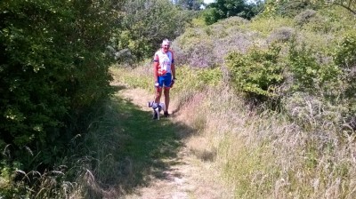 Photo: Une promenade dans une partie du Zwin.
Actuellement,
les vestiges de ce bras de mer constituent une réserve naturelle (158
ha dont 33 aux Pays-Bas) qui représente un biotope unique pour de
nombreux oiseaux et plantes. À noter que cette réserve est traversée par
la frontière belgo-néerlandaise matérialisée par deux bornes frontière.
Une partie de la réserve (60 ha) est accessible au public (http://www.zwin.be).
Après
une heure de visite nous patons en voiture pour Mariakereke (au sud
d’Ostende) où nous prenons un rafraîchissement sur lpromenade de la mer.
D’ici, je reprends mon vélo descend de Mariakerke à Middelkerke.
MIDDELKERKE –
La station balnéaire de Middelkerke est une commune néerlandophone de
Belgique située en Région flamande, sur la Mer du Nord à l’ouest
d’Ostende, dans la province de Flandre-Occidentale. La commune comprend
les localités de Leffinge, Lombardsijde, Mannekensvere, Middelkerke,
Schore, Sint-Pieters-Kapelle, Slijpe, Westende et Wilskerke.
 Photo: Middelkerke – la promenade.
Le Noordzeecross est une course de cyclo-cross tenue en février à Middelkerke, et qui fait partie du Superprestige (http://www.noordzeecross.com/)
Je
continue le long de la mer juusqu’à Nieuwpoort où je trouve une piste
cyclable qui longe un canal jusqu’à Veurne où je prend la route
nationale pour De Panne.
Voilà, encore une belle journée pour faire
du vélo dans ce beau pays qui est la Belgique : 147km à une vitesse
moyenne de 22,46km/h.
_________________
English text:
Cycling trips in the Belgian province of West Flanders.
Tuesday 30 June 2015 : 146,92 km, average speed of 22,46km/h.
Itinerary 1: De Panne – Veurne – “Boyau de la Mort” (Diksmuide) – Diksmuide – Esen – Zarren – dir. Kortemark – Lichtervelde – Zwevezele – Wingene – Wildenburg – Beernem – Oedelem – Sijsele – Vivenkapelle – Damme – Lapscheure – Hoeke – Knokke-Heist (along the esplanade to Knokke, Het Zoute, et Het Zwin (nature reserve).
Garmin GPS : https://connect.garmin.com/modern/activity/821167924
Itinerary 2: Mariakerke (south of Ostend), along the beachfront to Middelkerke, Westende, Nieuwpoort – cyclepath beside the Nieuwpoort-Duinkerke Dijk – Veurne – De Panne.
Garmin GPS : https://connect.garmin.com/modern/activity/821168011
Parts of the explanatory texts below (in italics) giving details of different sites, villages and towns have been gleaned from the internet, in particular Wikipedia.
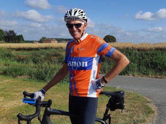
Today’s
cycle ride starts from our hotel in De Panne and it’s my intention to
cycle the northern half of the Province of West Flanders.
I take the
N35 to Veurne and there I take the road to Diksmuide. Near Scheewege, I
leave the main road in the direction of Stuivekenskerke to arrive at my
first port of call of the day: the “Trench of Death on the river Yser.
DIKSMUIDE – Tour de l’Yser (Trench of Death) – last remaining trenches of WWI
This
kilometre-long network of revetments, saps and dug-outs was one of the
most dangerous Belgian positions on the Western Front, situated just 50
metres from a German bunker. As a result, the trench was subjected to
almost constant fire from the Germans. The site has recently been
renovated and a new visitor centre was opened. Using maps, photographs,
videos and war memorabilia, the exhibition tells the story of life – and
death – in the front-line.
Trench of Death (http://www.flandersfields.be/en/explore/trench-death)
 Photo: Le monument at the Trench of Death.
After
my photoshoot, I ride to Diksmuide where I find the road to Esen,
Hoogland, Zarren, Sint-Henricus and Lichtervelde. From Lichtervelde I
ride to my next town on my list; Wingene, noted for its “Fêtes
Breughéliennes”.
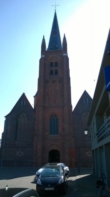 Photo: The church in Wingene.
WINGENE (“Breughélienne”
Festivals) – Wingene is a municipality located in the Belgian province
of West Flanders. The municipality comprises the towns of Wingene proper
and Zwevezele. On January 1, 2006, Wingene had a total population of
13,136. The total area is 68.42 km² which gives a population density of
192 inhabitants per km².
From Wingene I head north to Beernem,
Sijsele annd Damme. It appears to me that the roads are heavily
congested in Flanders, whether on the main national roads or on the
smaller roads. What I find extremely good is that nearly every road has
cycle tracks.
DAMME – Damme is a picturesque medieval town in the Flemish polders at a stone’s-throw from historic Bruges and the Belgian coast.
Very
few small towns have so many monuments as Damme: the gothical town
hall, the Schellemill, the 13th-century Sint-Janshospital, the partially
restored town walls, old farms etc. In the surrounding villages you
will also find various architectural masterpieces that bear witness of
the rich past of this region (http://www.damme-online.com/gb.htm).
 Photo: One of the canals passing through Damme.
Three
large canals run through Damme: the Damse Vaart, the Leopoldcanal and
the Schipdonkcanal. The Damse Vaart is undoubtedly the most well known
with tourists: you can fish here (you require a permit of course) and
make a great cycling excursion from Bruges to Sluis. At the Dutch
border, you will find several creeks, remains of medieval floods, that
attract quite a lot of birdlife.
My ride from Damme to Het Zwin is
full of difficulties, with blocked roads, very few signposts and
diversions.I finnd myself in Lascheure where I ride a part of the main
Expressway. Very quickly I find the cyclepath which leads me all the way
to Knokke-Heist.
The whole of the Belgian coast is built-up; I find
my way to the seafront and ride the esplanade all the way up the coast
to Het Zoute. Here I phone my wife Christine who has come to fetch me.
We meet up and visit a part of Het Zwin.
HET ZOUTE – Het Zwin Nature Reserve
– The Zwin is a nature reserve on the North Sea coast, at the
Belgian-Dutch border. It consists of the entrance area of a former tidal
inlet which during the Middle Ages connected the North Sea with the
ports of Sluis and Bruges inland.
 Photo: The beach at the Zoute.
The
present-day nature reserve was founded in 1952. It has an area of 1.25
square kilometres in Knokke-Heist, Belgium and 0.33 square kilometres in
Sluis, Netherlands. It is famous for its large variety in
salt-resistant flora, such as sea lavender. It is also popular with bird
watchers. There is a small zoo with some major domestic birds and it is
one of the few places in Belgium with a population of white storks (http://www.zwin.be).
After
an hour’s visit we drive south in the car to Mariakereke (south of
Ostend) where we take some light refreshment and take a few holiday
snaps. I get my bike out of the boot and ride south from Mariakerke to
Middelkerke.
MIDDELKERKE – Seaside resort – Middelkerke is a
municipality located in the Belgian province of West Flanders, on the
North Sea, west of Ostend. The municipality comprises the towns of
Leffinge, Lombardsijde, Mannekensvere, Middelkerke proper, Schore,
Sint-Pieters-Kapelle, Slijpe, Westende and Wilskerke.
 Photo: Before I ride on to Middelkerke and De Panne, I stop off at Mariakerke for a welcome refreshment.
The Noordzeecross is a February cyclo-cross race held in Middelkerke, which is part of the Superprestige (http://www.noordzeecross.com/).
I
continue along the seafront to Nieuwpoort where I find the cyclepath to
Veurne and the national road back to the hotel in De Panne.
Another good day’s cycling of 147km at an average speed of 22,46km/h.
 Photo: Le Monument de Mont Guynemer.
 Photo: L’étang de Zillebeke.
 Photos: Kemmelberg dans la distance.
 Photo: L’église de Ploegsteert.
 Photo: L’église à Zwevegem.
 Photo: Le moulin au Tiegemberg.
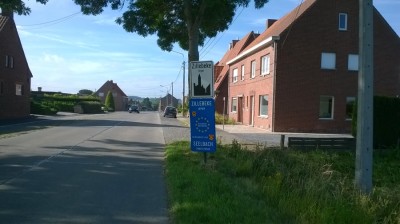 Photo: Coming into the village of Zillebeke.
 Photos: 1. At the bottom of the hill. 2. The last section of the cobbled hill with a gradient of 23%.

