Blog Image

Geoff's blog

Days in the life of Geoffrey S. Nunn:

Walking, cycling, running, gardening and so on.

Cycling in Catalonia: Tossa and Romanya

My cycling trips Posted on Wed, April 16, 2014 18:38:48

Today’s good weather continued and I left around 8.30 for a cycle along the coast to Tossa de Mar.

The intention was to get to Tossa turn around and come back on the same route. However, at Tossa I decided to continue on to Llagostera and from there the long hill-climb to Romanya de la Selva and the great downhill slalom to Calonge and home.

The Garmin routes can be viewed at:

http://connect.garmin.com/activity/481033178

and

http://connect.garmin.com/activity/481036104

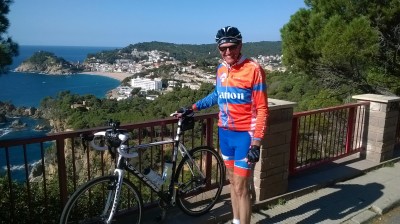
Photo: A kind German tourist took a photo of me with Tossa de Mar in the background.

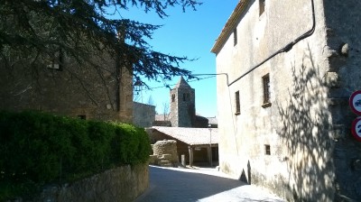
Photo: The village of Romanya de la Selva.


Cycling in Catalonia cont.

My cycling trips Posted on Tue, April 15, 2014 12:27:19

Since my last blog I’ve been out on six more circuits, mostly following the same routes as I’m comfortable using roads that I know very well here.

My accident in August 2006 has made me very conscious of the dangers of cycling, especially in Spain, when a white-van man knocked me off my bike and then drove off leaving me with a pelvis fractured in five places.

Seven weeks in traction in the local hospital in Palamós and then six months of reeducation — unforgettable.

To date, I have clocked up 550 km since the start of our April holiday on the Costa Brava. Saturday’s trip of 92 km was the hardest so far as I rode up “Els Angels”, between Madremanya and Quart (near Girona). I’d left Sant Antoni at sea level and arrived at the sanctuary of Els Angels at 480 m above sea level.

There’s a five-km hill-climb of an average of 8% (between 4 and 12% gradients on the way up. I last did this trip on the bike in 2005 and had forgotten how difficult it can be. Anyway, I did it and am very pleased with myself.

The Garmin GPS can be viewed at http://connect.garmin.com/activity/479819563

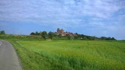
Photo: The village of Madremanya, just before the hill-climb to “Els Angels”.

Photo: The sanctuary at “Els Angels” at 480 m above sea level.

After the descent from Els Angels to Quart, I picked up the Ruta del carillet (cycle track) all the way back to Platja d’Aró, then the coast road to home.


Cycling in Catalonia

My cycling trips Posted on Fri, April 04, 2014 19:09:20

The holiday in Spain got off to a cold and damp start: 15°C and a couple of days of rain. Back home in Belgium it’s 23°C smiley

Anyway, today, 4 April, the temperature has gone up and the sun is shining. After a light lunch, I decided to ride into the hill range known as “Les Gavarres”. A lot of cyclists out on the road today, which is always good to see; could be TeamSky with Sir Bradley Wiggins doing some training!

The route took me from Sant Antoni to Cassa de la Selvà by the Ruta del carillet, then on to La Bisbal de l’Empordà, Calonge and return to Sant Antoni.

Sant Antoni de Calonge – Calonge – Platja d’Aró – S’Agaró – piste to Castell d’Aró – Santa Cristina d’Aró – Llagostera then to Cassa de la Selvà – road GI664 to Santa Pelliaia – Sant Sadurní de l’Heura – Cruïlles – La Bisbal de l’Empordà, road GI660 to Calonge and return to Sant Antoni.

I filmed all of today’s circuit and will endeavour to add a snippet in the days to come.

The map can be viewed on the Garmin site at:
http://connect.garmin.com/activity/473296946

Earlier in the week, on Wednesday 2nd, to loosen up my legs after the drive down, I took my familiar trip along the cycling track once used by a narrow-gauge railway (see http://www.catalunya.com/vies-verdes-ruta-del-carrilet-ii-girona-sant-feliu-de-guixols-24-1-132)

The map can be viewed on the Garmin site at:
http://connect.garmin.com/activity/472196657


Douce France 2

My cycling trips Posted on Thu, March 27, 2014 12:49:56

Very similar to Douce France 1, however this time I’m cycling with Bernard “Big Moustaches” Jeanjean.

There’s is some blue sky and occasionally a bit of sunshine, but in general it’s 11°C with a cooling north-easterly wind. After Sorbey, near Pillon, we had some slight rain, although nothing to worry about.

The route we took can be viewed on the Garmin site at:

http://connect.garmin.com/activity/468367941

Detailed itinerary for the circuit is: Mussy-la-Ville (B) – Signeulx – St Remy – Ruette – Grandcourt – Allondrelle/La Malmaison (F) – Villancy – Longuyon – Noërs – Z.I. Kaiser – Sorbey – à la D66 près de Pillon, prendre à gauche dir. Arrancy, prendre chemin agricole (avec un panneau “No Entry, sauf ayants droit” – Rouvrois-sur-Othain, à droite sur D618, puis à gauche avant garage Citroën – Remenoncourt – Arrancy-sur-Crusnes – Beuveille – Fort de Fermont – Fermont (village) – La Roche – Montigny-sur-Chiers – Villers-la-Chèvre (sortie par Chemin du Bois de St Pancré) – Gorcy – Baranzy – Mussy.

Photo: The château at Remenoncourt, near Arrancy-sur-Crusnes, France.


Douce France 1

My cycling trips Posted on Wed, March 12, 2014 14:50:25

Le beau temps continue et
aujourd’hui mon vélo m’emmène en France.

Les villages/villes visités sont:
Mussy-la-Ville (B) – Baranzy – Gorcy (F) – Villers-la-Chèvre –
Fresnois-la-Montagne – Braumont – Longuyon – Noërs – Z.I. Kaiser – Sorbey – à
la D66 près de Pillon, prendre à gauche dir. Arrancy, prendre chemin agricole
(avec un panneau “No Entry, sauf ayants droits” –
Rouvrois-sur-Othain, à gauche sur D618 – à droite Arrancy-sur-Crusnes –
Beuveille – Fort de Fermont – Fermont (village) – La Roche –
Fresnois-la-Montagne – Tellancourt – Saint-Pancré – Buré-la-Ville – Saint-Rémy
– Signeulx – Mussy.

… et la randonnée
peut être visionnée à :
http://connect.garmin.com/activity/459651563

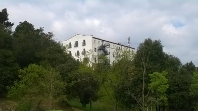
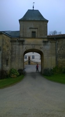
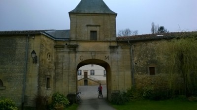
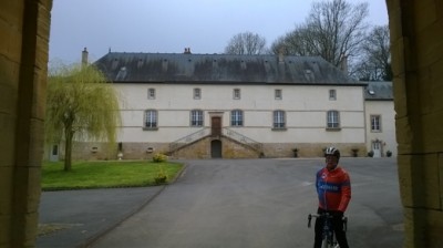
Photo : Un blockhaus de la Ligne Maginot, entre Noërs et Sorbey.

Photo : Le château à Sorbey.

Photo : À Arrancy-sur-Crusnes je prends la direction de Beuveille.

Photo : Le Fort de Fermont, une partie de la Ligne Maginot, est ouvert aux visites des touristes.


Un week-end de cyclisme

My cycling trips Posted on Sun, March 09, 2014 14:32:08

08/03 et 09/03/2014 : Le temps fait magnifique : ciel bleu, plein soleil, de 14 à 17°C ; 10°C au-dessus des températures normales.

Deux sorties ce week-end, samedi en solo et dimanche avec quelques membres du club.

Les itinéraires se trouve sur le site de Garmin à :

Une petite randonnée dans la Gaume profonde

http://connect.garmin.com/activity/457700717

et

une visite au Grand-duché de Luxembourg

http://connect.garmin.com/activity/457700395

Des photos de mon circuit de samedi :

Photo : Le cimetière militaire franco-allemand de la Grande Guerre. Un des nombreux cimetières militaires de 1914-1918 dans cette région et aillleurs.

Photo : La Vallée de Rabais, entre Virton et Ethe est très populaire en été avec les touristes flamands et néerlandais.

Photo : Le lac à Rabais est fréquenté par de nombreux pêcheurs.


Le « Home-made Steak and Kidney Pie »

My cycling trips Posted on Wed, March 05, 2014 17:02:11

ENGLISH TEXT BELOW.

Finalement, les
températures d’hiver arrivent et quelques jours ensoleillés s’annoncent.
Ce matin je pars à 10h45 en direction de Virton. Sur la piste cyclable à côté
du zoning industriel de Latour je dois faire demi-tour (travaux en cours) et me
remettre sur la route nationale.

Le circuit
d’aujourd’hui peut être visionné à http://connect.garmin.com/activity/455557074

La
randonnée — Mussy-la-Ville – Signeulx – demi-tour sur la piste cyclable à
Ruette/Latour – St Mard – Harnoncourt – piste cyclable Lamorteau – Écouviez
(France, dept. de la Meuse) – Verneuil-Grand – Verneuil-Petit – Thonne-la-Long
– Sommethonne – Gérouville – La Soye – Limes (demi-tour) – La Soye –
Bellefontaine – Ste-Marie-sur-Semois – Fratin – Buzenol – Chantemelle – à doite
au carrefour Haut-des-Loges – St Léger – Mussy.

Photo : Je
tourne à droite pour Verneuil-Petit; en haut à gauche du panneau on voit la
Citadelle de Montmédy.

Photo : Sur
la route de Verneuil-Grand à Verneuil-Petit : le Basilique d’Avioth.

Photo : Je
prends la mauvaise direction en quittant Gérouville et me trouve à Limes.

Photo : Limes —
je fais demi-tour et retournes vers La Soye et Bellefontaine.

Photo : Chez moi à 14h35 et il y a un merveilleux «Home-made Steak and Kidney Pie».

Finally, winter temperatures arrive and a few sunny days are announced. This morning I leave at 10:45 in the direction of Virton. On the cycle path near the Latour industrial zone, I have to do a U-turn (work in progress) and regain the main road.

The circuit today can be viewed at http://connect.garmin.com/activity/455557074

It included Mussy-la-Ville – Signeulx – U-turn on cycle path Ruette/Latour – St Mard – Harnoncourt – cycle path Lamorteau – Écouviez (France, dept. de la Meuse) – Verneuil-Grand – Verneuil-Petit – Thonne-la-Long – Sommethonne – Gérouville – La Soye – Limes (demi-tour) – La Soye – Bellefontaine – Ste-Marie-sur-Semois – Fratin – Buzenol – Chantemelle – à doite au carrefour Haut-des-Loges – St Léger – Mussy.


Le Circuit de Printemps: Grandcourt (Virton)

My cycling trips Posted on Sun, March 02, 2014 11:57:24

Voici ma dernière randonnée que j’ai mis sur le blog de notre club “Les Cyclos du Sud“:

http://blog.cyclosdusud.be/#post133


« PreviousNext »